The use of natural colours according to land use or climate may give the map-reader a realistic feeling of the area.
The following example is from the Tibesti Mountains (Chad, Africa) in the Sahara desert. The reddish yellow colors reinforce the impression of an arid landscape. The choice of different light directions in the map (northwest to northeast) was probably deliberate in order to emphasize certain forms.
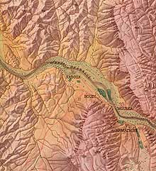
“Bardai” (section), original scale 1:25,000, © National Academy for Civil Engineering, Berlin, 1967.
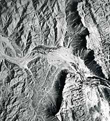
Aerial photography of Bardai.
The map “Die Welt ist bunt” (The World is Colourful) divides the earth’s surface into 10 climate categories. The reddish orange describes the hot, burned soil of the desert. Yellowish orange depicts semi-desert and desert steppe. Green tones, varying between a green-brown (coniferous woodland), green-yellow (agricultural land) to a green-blue (rainforest), stand for humid areas.
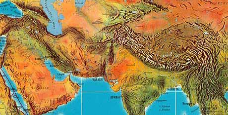
“Die Welt ist bunt” (section), original scale 1:40 million (size 48 x 138 cm), © Falk Verlag, 1963. Relief shading by Fritz Hölzel, colours by W. Dylewski.
The following map uses the same shaded relief as the example illustrating hypsometric colours. Here, the brown colour represents the arid desert better.
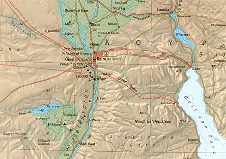
“Nildelta, Suezkanal, Jordangraben” (section), original scale 1:2 million. © Schweizer Weltatlas, 1997.
Further remarkable examples of naturally coloured reliefs:
- Relief de la Suisse by Eduard Imhof.
- Walensee by Eduard Imhof.
- New Europe map by Hal Shelton.
- Grand Teton and Kenai Fjords National Park by Tom Patterson, who combines relief shadings and aerial photographs. For more details, see Patterson’s paper Getting Real: Reflecting on the New Look of National Park Service Maps.