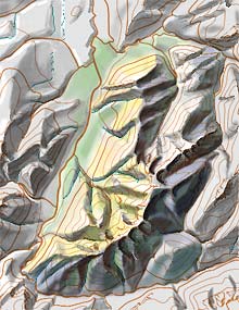
Photoshop is the standard software for raster image manipulation. It is also the most full featured application for manually drawing shaded relief from scratch or for enhancing and correcting analytical relief generated from digital elevation models.
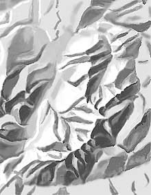
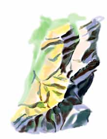
Experimental coloured relief shading with Photoshop by Heinz Leuzinger. Area of La Gruyère, Switzerland. © Institute of Cartography and Geoinformation, ETH Zurich.
Drawing shaded relief with Photoshop (or with another raster software application) rather than with traditional pencil or ink has the following advantages:
- The possibility of making multiple corrections to the same area.
- Every production step is “undoable”.
- Simultaneously viewing multiple cartographic base layers (contour lines, the river network and other structure lines) with the shaded relief.
- Shorter production time.
Tom Patterson provided us with a short animation showing the process of relief shading with Photoshop.