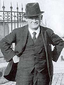
Andreas Hefti (1862–1931) worked as a technical draftsman for several years for Prof. Fridolin Becker at today’s ETH Zurich. During that period, Hefti designed the so-called “war-game maps” for the officers clubs of Zurich and Winterthur. Army officers used these large-scale maps for indoor tactical training during the winter as a substitute for natural terrain exercises.
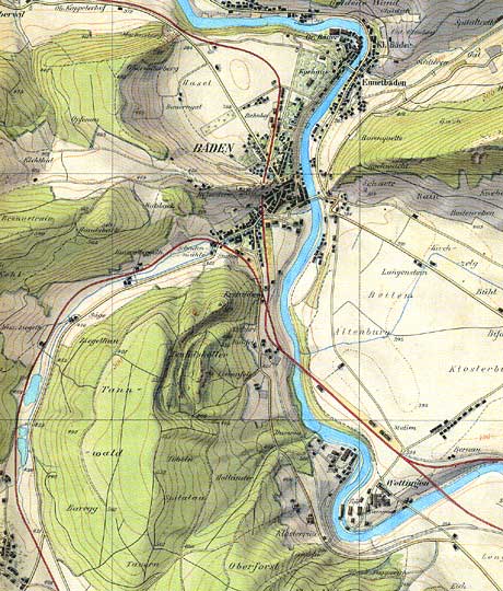
“Kriegsspielkarte” (section), 1897. Original scale at 1:10,000.
Hefti enlarged the official topographic maps from 1:25,000 (“Siegfried-Atlas”) to 1:10,000-scale. He drafted the final maps in colour, and as a novelty, included impressive hillshading tints. Never printed, the rediscovery of Hefti’s maps occurred only a few years ago. They are unmatched masterpieces in large scale relief mapping of Switzerland.
The description and the images on this page are based on the article “Andreas Hefti, Topograph und Kartograph 1862–1931” by Arthur Dürst in Cartographica Helvetica 7/1993.
Further resources
- Wargame Maps on e-manuscripta:
http://dx.doi.org/10.7891/e-manuscripta-57924
Source: Zentralbibliothek Zürich